|
||
|
|
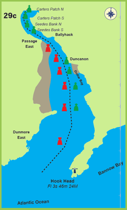
Waterford Estuary Section 29c: | |
|
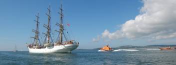
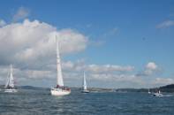
Waterford Estuary is bordered by a rich heritage of lighthouses, forts, fishing ports and beaches. Waterford Estuary leads to the Three Sister Rivers: the Barrow, Nore and Suir. The estuary is bordered with rich heritage and it is well worth visiting some of the harbours en route.
To
enter the estuary from seaward, the initial fix waypoint for a final
approach to the marked channel:
52°
10.740' N, 006° 56.320' W, east of Creadan Head. A potential race can
develop where the estuary tide meets the sea in rough conditions: a
very short chop with dark green to seaward and light green / pale blue
shore side. The chop is shorter on an ebb tide and longer / easier on
a flood tide. In extreme
Tide estimates HW Cobh +0021. There are strong tides of up to 3-4 knots inside the estuary following the channels. Outside Waterford Harbour: >West going stream -0100 Dover or +0450 Cobh >East going stream +0515 Dover or -0120 Cobh Inside Waterford Harbour: >Flood begins at +0210 Dover (-0425 Cobh) >Ebb tide begins at -0505 Dover (+0045 Cobh)
Charts Admiralty Chart 2046 has details of the following areas: >Waterford Harbour (1:25,000) >Waterford Port (1:7,500), Dunmore East Harbour (1:5,000) >Cheekpoint to New Ross (1:25,000), New Ross (1:10,000)
Contacts
>Port
of Waterford Harbour Master: VHF ch16 & 14 >Dunmore East Harbour Master: + 353 (0)51 383166 >New Ross Harbour Master: + 353 (0)51 421303 >Kilmore Quay Harbour Master: Tel: +353 (0)53 9129955 E-mail: hmkilmorequay@eircom.net or VHF Ch 9 |
|
|